
Groundwise Searches Ltd
- 01702 615566
- Contact Us
- Login
- Register
Groundwise Searches Ltd
Utility search for proposed safety improvements to the bank of the River Soar in Leicester.
Public Sector
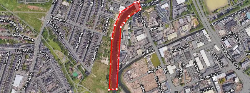
The Environment Agency have used our Utility Search service since 2007 and we have processed many hundreds of their searches. The searches predominantly involve works on sites such as the one shown on the map below. This image is the search area as defined by the EA using our own innovative mapping system and tools for drawing boundaries for the extent of sites. For this site the interest is fencing along a stretch of the river Soar in Leicestershire. Ultimately this site may require a contractor breaking the ground to carry out further works. The EA use a Groundwise Utility Search service to collate information on below ground hazards that may be found before such work takes place
We carried out the research on this site and provided the EA with a pack of utility data and responses. As was expected in such an undeveloped area not a great deal of utility apparatus was found, however, running along the site was an electricity cable belonging to Western Power Distribution that will need to be taken into account by any on site workers.
The Environment Agency https://www.gov.uk/government/organisations/environment-agency is the leading public body for protecting and improving the environment in England and Wales
Hilltop SEND School Project location: Rotherham, South Yorkshire Client: The Great Yorkshire Build Sector/Industry: Private, Public & Third Sectors Project Information: A client...
View case studySolar Park Project location: North Scotland Sector/Industry: Renewable Energy Project Information: Our client instructed us to undertake a full Utility Search, for a site covering...
View case studyElectric Vehicle Charging Station Project location: Banbury, Oxfordshire Sector/Industry: Electric Vehicle Charging Network Project Information: Our client was at the planning stage...
View case study